|
Geology
along the Peak to Peak highway
|
|
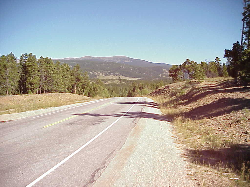
As it parallels the continental divide, Colorado's Peak-to-Peak highway provides some of the most breathtaking scenery in North America. For the geologist, the beauty is not just in vistas of distant summits but closer to the road—right beside the road in fact. To the geologist, the Peak-to-Peak provides some of the most interesting road cuts in the inner Solar System. Come with us as we travel north from Nederland to Estes Park and Rocky Mountain National Park with a side trip to Brainard Lake and the Indian Peaks Wilderness.
We have Ogden Tweto's Geologic Map of Colorado with us. According to it we are traveling through a region of Precambrian biotitic gneiss, schist, and migmatite. These metamorphic rocks range in age from 1.7 to 1.8 million years old and are derived mostly from sedimentary deposits. About 3.6 miles from Nederland we stop along side this roadcut.
The rock appears shiny and a little green. At about mile 6.1 we pull off the road for a truly "Kodak®"
moment. The left edge of the road just drops away and we find ourselves
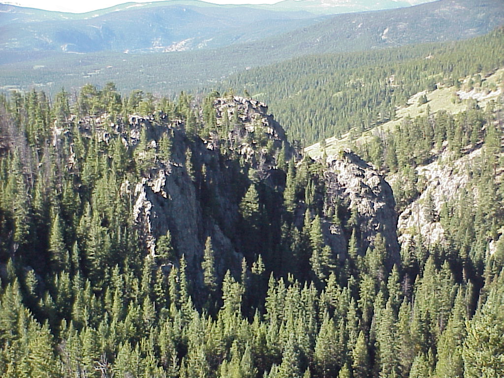
looking out upon an enchanted landscape of granite pinnacles. Consulting our geologic map, this granite appears to be Precambrian in age (1.6 to 1.7 million years). You can see how the edges of this formation have spalled away, giving the rocks a rounded appearance. Reluctantly we get into our van and take off. We want to get to Brainard Lake in time to cook some lunch.
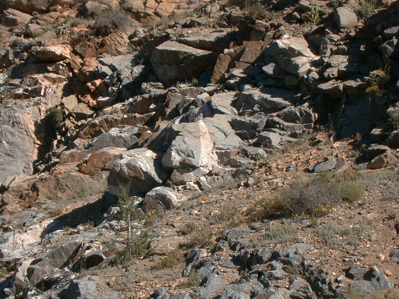
We've seen these features all along our way, crisscrossing the schist, gneiss, and granites. Some of them are feldspar, others are quartz, still others are a mixture. These pegmatite may have forced their way up through the fractures in the the rocks as recently as between 24 to 29 million years ago. At mile 7.5 we stop and take this picture of this highly metamorphosed
gneiss. Most of the rocks in this area originally were shale, siltstone, and sandstone, along with some volcanic rocks deposited about 1.8 to 2 billion years ago in an ancient sea. Between 1.7 and 1.6 billion years ago, these sedimentary rocks were caught in a collision zone between sections of the Earth's crust called tectonic plates. These rocks, then in the core of an ancient Proterozoic mountain range, were recrystallized into metamorphic rocks by enormous heat and pressure resulting from the collision. 
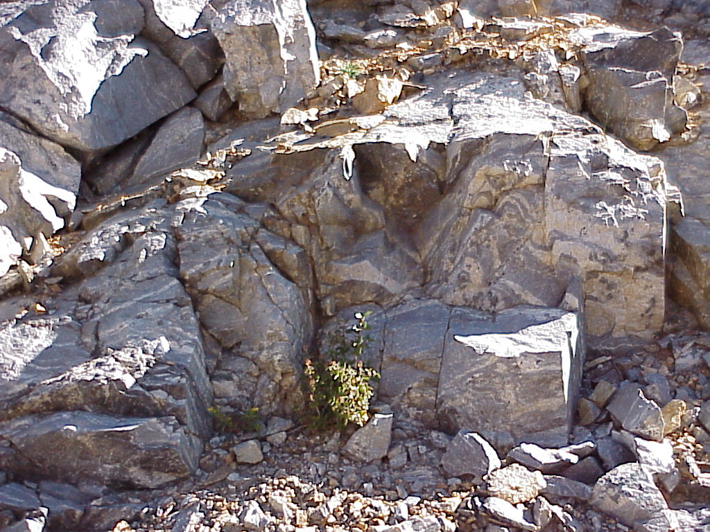
The shale, which contained mostly clay minerals and some very fine sand and silt, was converted into biotite schist. The layers with more sandstone were converted into biotite gneiss. At the town of Ward we turn west and head up to Brainard Lake. It's a steep climb, going from 9250 feet to 10,300. We climb out of the Precambrian formations and into Quaternary glacial deposits. Everywhere you look you see boulders—each different from the one next to it. This picture is taken on the shore of Brainard Lake, looking west at the Indian Peaks. We see Audubon, Toll, Pawnee, Shoshoni, Navaho, and Arikaree. |